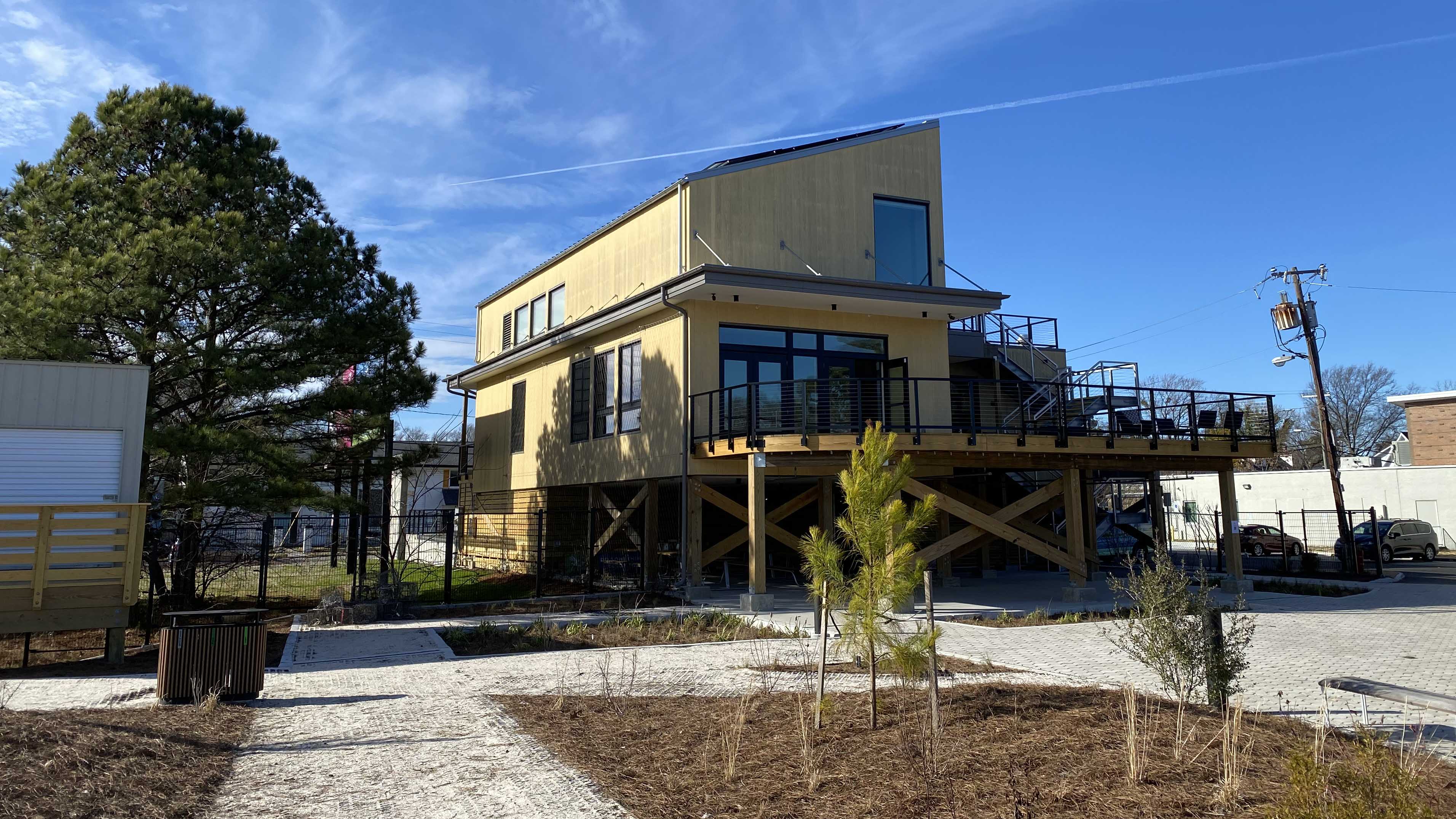
Sea level rise is projected to eventually swamp the roughly one-acre spot of land along Knitting Mill Creek in Norfolk where the Elizabeth River Project chose to build its brand new headquarters.
Over the next six decades, waters will encroach until the shoreline has moved right up to the nonprofit’s $8 million new building.
Rather than fight that future, the environmental organization is embracing it. In fact, it’s why officials bought the land, previously home to an American Legion, in the first place.
“We thought, let’s go to one of the worst problems” with flooding, said Marjorie Mayfield Jackson, Elizabeth River Project's executive director. “And let’s demonstrate, how do you take care of the Elizabeth River, as well as the people, as sea levels rise.”
After almost four years of construction hindered by cost and pandemic delays, the nonprofit is set to formally open the roughly 6,500-square-foot Ryan Resilience Lab later this spring.
Leaders recently gathered to celebrate a part of the project visitors won’t see: the legally binding contract promising to dismantle the very same building.
The Elizabeth River Project signed what it says is the nation’s first privately held rolling conservation easement, committing itself to return the land to nature in the face of climate change.
“When that final trigger point is reached, we will no longer work here,” said resilience manager Luísa Black Ellis.
“We leave, and the waters come.”

Pelicans take a dip in Knitting Mill Creek behind the resilience lab's research dock.
‘A global model’
Before its eventual surrender to rising waters, the new resilience lab will demonstrate how to live alongside them.
On a recent tour of the building, former Virginia First Lady Pam Northam, who now works for the Elizabeth River Project, pointed out some of its green features.
There are solar panels, a rain garden, cisterns that capture rainwater to reuse in the building’s toilets, pavers in the parking lot that allow water to filter underground – even the carpeting is made from fishnets recycled from the ocean.
An accessible walkway out front doubles as a floating dock that rises with flooding.
It’s “really a global model for urban coastal resilience that we have right here in our beautiful city of Norfolk,” Northam said.
Ellis said the goal is to show local residents and businesses how they can take their own actions to limit and adapt to climate change.
A lot of resilience work is done at an institutional or academic level “in such a way that it's totally inaccessible for the everyday person," she said.
“There are very few ways that I think an average person feels empowered to take action and see the difference that that action will take when it comes to such a huge problem.”
Those efforts include trying to make the North Colley area into an “eco-corridor,” getting businesses on board with green practices. A marina that uses only electric boats has already set up shop next door.
The nonprofit is still finishing construction on a raised circular boardwalk that will allow visitors to walk above newly reconstructed wetlands.
Those wetlands are much deeper than they would usually be, Ellis said. That’s to allow the wetlands to migrate inward, rather than drown, with sea level rise.
“Not that we're encouraging sea level rise, but we just want to be equipped for it when it comes.”

Leaders sign the rolling conservation easement earlier this month.
A historic legal tool
The idea for a rolling easement started with another Norfolk nonprofit, Wetlands Watch.
The organization looks for experimental new ways to adapt to sea level rise, said executive director Mary-Carson Stiff.
The concept has been floated for many years, including by the federal Environmental Protection Agency.
In a primer on its website, EPA researchers describe rolling easements as “an alternative vision, in which future development of some low-lying coastal lands is based on the premise that eventually the land must give way to the rising sea.”
Stiff said Wetlands Watch heard of the Elizabeth River Project’s plans for the resilience lab and thought it was a perfect testing ground to make sure the nonprofit’s future leaders are held to current promises.
The easement is held by a local land trust called the Coastal Virginia Conservancy, which aims to conserve land around Hampton Roads.
The groups worked with the Virginia Institute of Marine Science to develop specific markers of sea level rise that will determine the site’s future.
Officials will do extensive monitoring when waters reach those trigger points. That doesn’t mean one big hurricane will force the Elizabeth River Project to pack up shop. The trigger points are set to be rolling averages over set time periods.
The final trigger point – around six feet of sea level rise, expected to happen in the 2080s – will set in motion the lab’s deconstruction.
Ellis said it was built in order to be easily undone, including recycling or reusing as many parts as possible.
Though it’s the first example of a private rolling easement she could find, Stiff doesn’t think it will be the last.
As sea level rise accelerates, coastal communities will have to grapple with public waterways encroaching onto private property rights, she said. Courts will likely have to answer questions about when structures have to be demolished, who pays for that and what happens to the land afterward.
“It’s really the science fiction of climate change policy and legal work that we have to do as a field and definitely as a region, given our incredible risk.”
Stiff said it was surreal to celebrate the resilience lab’s demise before it even completes construction.
“To build up the accomplishment and open and be so excited, but then in the same day, talk about deconstruction – it was mind bending for sure.”

The nonprofit's still finishing construction on a mesh walkway that will allow visitors to walk over wetlands.


